Silver is a mined mineral that has been an integral component of civilization for over 5,000 years. For centuries it has served as a monetary criteria for empires and countries. Silver investments, jewellery, and awards continue as its medical uses advance. As its photography use disappeared it became an anchor component of today's electronics. All mines have a life. Finding new mineable deposits is critical. These historical mines created silver's role in history.
Aspen
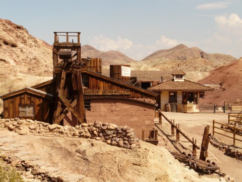
Historical Mines
In 1879, prospectors searching for another Leadville were led to the Aspen area by geological maps that showed outcrops of Leadville Limestone. They found silver ore on Aspen Mountain, but ore production was small until the Denver and Rio Grande Railroad reached the town in 1887 and provided economic shipment of ore to smelters. Ore occurs in the Mississippian Leadville Limestone and the lower
Barton Mine, also known as Net Lake Mine, is an abandoned surface and underground mine in Northeastern Ontario, Canada. It is located about 0.50 km (0.31 mi) north of the Temagami Arena in Temagami North and just east of the Ontario Northland Railway in northwestern Strathy Township. Dating back to the early 1900s, it is one of the oldest mines in Temagami. Barton was the site of a fire in
Batopilas (Spanish: [batoˈpilas] ( listen)) is a small town, and seat of the surrounding municipality of the same name, in the Mexican state of Chihuahua, located along the Río Batopilas at the bottom of the Batopilas canyon, part of the Copper Canyon. As of 2010, the town of Batopilas had a population of 1,220. Its elevation above sea level is 578 metres (1,896 ft). The town is situated in
Beanland Mine, also known as Clenor Mine, is an abandoned surface and underground mine in Northeastern Ontario, Canada. It is located about 1 km (0.62 mi) west of Arsenic Lake and 4 km (2.5 mi) northwest of the town of Temagami in central Strathy Township. It is named after Sydney Beanland, who first claimed the mine site in the 1920s and was a director for the mine from 1937 to
Berggeschrey or Berggeschrei ("mining clamour") was a German term for the rapid spread of news on the discovery of rich ore deposits that led to the rapid establishment of a mining region, as in the silver rush in the early days of silver ore mining in the Ore Mountains. It is similar in some respects to the gold rush in North America.
Big Dan Mine is an abandoned underground mine in Northeastern Ontario, Canada. It is located about 1 km (0.62 mi) southwest of Net Lake and just west of the Ontario Northland Railway in east-central Strathy Township. It is named after Dan O'Connor, who first claimed the site in the 1890s.
Mining operations began at the site in the early 1900s, making Big Dan one of the oldest mines in
Blue Hawk Mine is located on the east slope of Blue Grouse Mountain, on the west side of Okanagan Lake. The mine is just a few kilometres from Downtown Kelowna in the Canadian province of British Columbia.
The mine consists of several adits operated for a single year, 1934, and has been virtually abandoned ever since. British Columbia's Ministry of Energy, Mines and Petroleum Resources refers
Caribou is a former silver-mining town, now a ghost town near Nederland in Boulder County, Colorado, United States. It was named after the Caribou silver mine nearby. The Caribou Ranch recording studio is several miles away, on the road from Nederland up to Caribou.
History
1861 to 1969
A prospector named Conger discovered placer gold downstream from Caribou in 1861. He eventually followed the
Silver veins were discovered in the Central City-Idaho Springs district a short time after gold was discovered there in 1859. However, mining the silver veins was delayed for the most part until smelters were built in the late 1860s. The veins of the district are zoned in a roughly concentric manner, with gold-bearing pyrite veins in the center, and silver-bearing galena veins more common in
The Cerro Colorado Mountains are a low mountain range in southern Pima County, Arizona, USA. The highest point of the range is (5,319 feet (1,621 m)). The range consists of a NNW–SSE trending ridge with several shorter ridges extending off the main ridge to the ENE. The higher portions of the range cover an area of about 21 km2 (8.1 sq mi), with dimensions of 6.8 km (4.2 mi) by 4.0 km